Last Updated on 29/11/2022
Glaciers, covering almost 10% of the entire land surface of the Earth, are one of the most important geological formations for the survival of humankind, as glacial ice is the largest reservoir of fresh water on Earth providing an essential water source in the form of meltwater, specially in temperate, alpine and seasonal polar climates. In India, the Himalayan range is host to a number of glaciers, source to the majority of the river network that irrigates and sustains the great northern plains. In India, many glaciers and the rivers emanating therefrom are considered sacred, specially in the state of Uttarakhand, often referred to as Devbhumi or the land of the Gods. Glaciers also provide a huge source of tourism, both for religious devotees or simple adventure seekers. Here’s a list of 10 most famous Glaciers in Uttarakhand.
Most Popular Glaciers in Kumaon and Garhwal Uttarakhand
- Gangotri Glacier
- Yamunotri Glacier
- Bandarpunch Glacier
- Pindari Glacier
- Kafni Glacier
- Milam Glacier
- Nanda Devi Group of Glaciers
- Khatling Glacier
- Doonagiri Glacier
- Satopanth Glacier
1. Gangotri Glacier
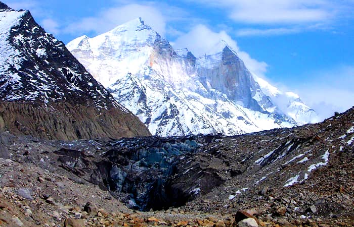
Gangotri Glacier is one of the primary sources of the river Ganges, the largest and the longest river in India, and undoubtedly the holiest and most revered by most Indians. Situated in the Uttarkashi District of Garhwal region of Uttarakhand, the glacier shares its name with the small but important town of Gangotri, which is one of the destinations of the Char Dham.
Devotees undertake the strenuous yet stunning trek from the town of Gangotri to Gaumukh to pray at the source of the holiest of rivers. This area also serves as a base camp for professional mountaineers looking to scale Shivalinga peak, the Bhagirathi peaks among others. Nestled among incredible peaks and stunning views at a height of almost 3415 metres, visiting Gangotri means going to one of the highest pilgrimages in India.
2. Yamunotri Glacier
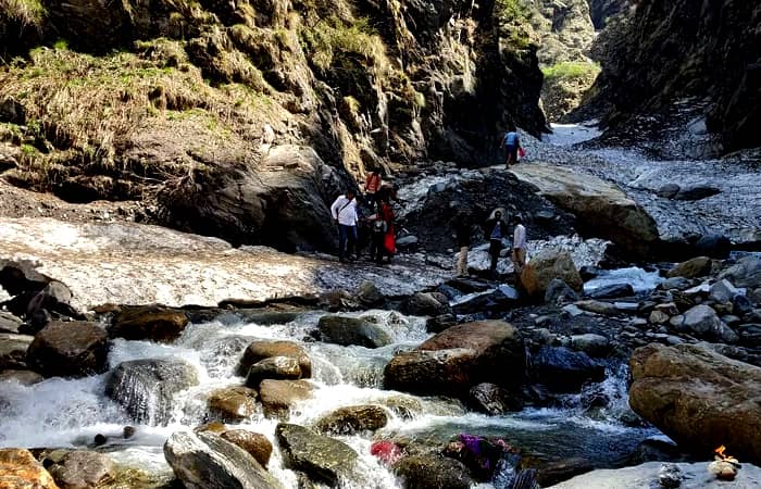
Champasar Glacier, the source of River Yamuna, one of the Holiest rivers in Indian culture and mythology, is for the very same reason often referred to as the Yamunotri Glacier. Located on the Kalind Mountain on the southwestern slopes of Bandarpoonch peaks at a height of 4421 metres, the glacier is extremely difficult to access, and as such devotees of tourists are not generally allowed to trek up to the actual glacier.
The trek is a beautiful one, with snow-clad mountains surrounding the path as it crosses through dense forests laden with snow, captivating streams and gorgeous lakes. After Yamunotri, the trek up to Saptrishi Lake, the frozen lake fed by Champasar Glacier.
3. Bandarpunch Glacier
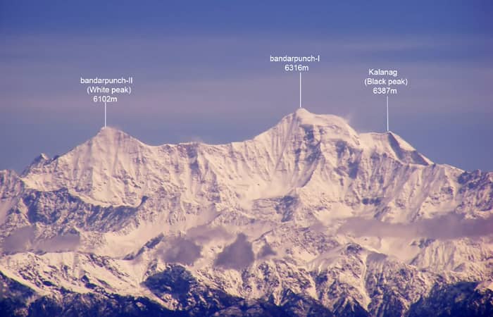
The Bandarpunch (Tail of the monkey) Glacier at around 6300 metres, lies in Uttarkashi district in the western Garhwal region, huddled broadly on the peaks of Bandarpunch I, Banderpunch II and Kalanag. It is a major source of the Yamuna river as it feeds Ruinsiara Tal and Hanuman Ganga River, both of which flow into the Yamuna.
The trek to the Bandarpunch Glacier commences from the village of Taluka, where one can reach either via Jeeps or by trekking from Soud. The way onward from Taluka takes trekkers through dense forests of walnuts, willows and chestnuts and into a snowy wonderland. The first major stop en route is the village of Osla after which the trek becomes a little difficult. Ruinsara Lake situated right below the snout of the glacier offers a perfect camping site.
4. Pindari Glacier
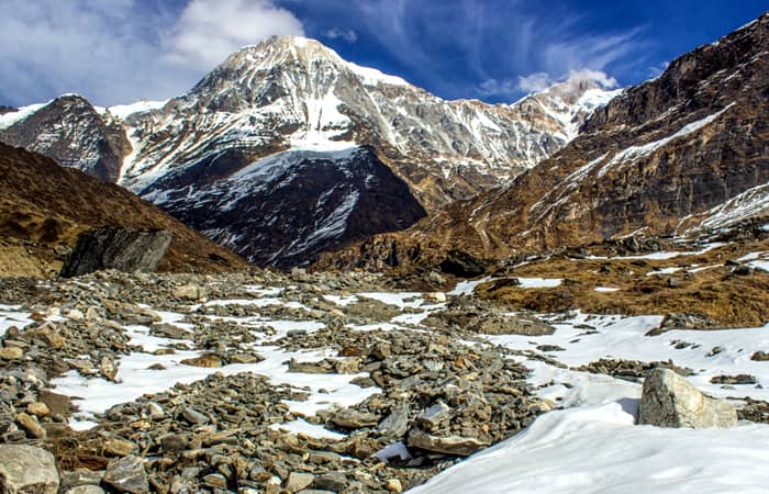
The Pindari Glacier trail, a 90 km round-trip trek from Loharkhet to Zero Point, Pindar and back, is a moderate level trek along the banks of the river Pindar traversing lush forests of oak and rhododendron, swift-flowing streams and magnificent waterfalls, breath-taking landscapes and panoramic views of the surrounding mountain peaks such as Nanda Devi, Nanda Kot, Panwali Dwar, Maiktoli etc. The trek usually takes around 6 days, and can even be attempted by amateur trekkers.
The trek starts from Loharkhet, and after crossing Dhakuri, reaches the village of Khati which is the last inhabited village on the trek. The rest of the trek to Zero Point is dominated by snow and ice, providing a surreal and never-before experience to the visitors.
5. Kafni Glacier
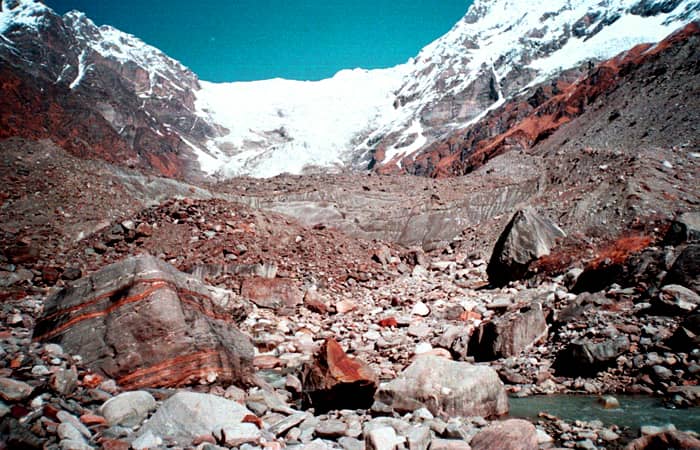
The Kafni Glacier lies on the left of the Pindar Valley at an altitude of around 3800 metres in the Bageshwar district of Uttarakhand, surrounded by the peaks of Nand Kot and Nanda Devi. The Kafni river flows from this glacier which goes on to merge with the Pindar River, eventually going on to meet the Ganga River.
In order to trek to Kafni Glacier, one has to first cross Zero point, Pindari glacier to reach Dwali. The return journey to the Kafni Glacier can be made from Dwali in one day, and the top of the trek offers a glimpse of the splendid vistas of the main Himalayan Ranges, a once in a lifetime experience for any lucky enough to visit this dreamlike paradise.
6. Milam Glacier
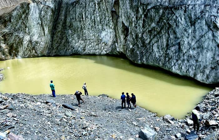
The largest glacier of the Kumaon region covering an area of 37 square kilometres, Milam glacier, is located in the Pithoragarh district of Uttarakhand, burrowed between the peaks of Trishuli and Kohli. The Gori Ganga River, an important tributary of the River Kali originates from the Milam Glacier.
The trek commences from Munsiyari, and trekkers have to navigate a 60 km path to reach the top. The trek is a relatively tiring one and takes approximately 10-15 days to the top and back, and as such ranked at a moderate level. The trek is undertaken between the months of May to October, as the path is inaccessible during the winter months.
7. Nanda Devi Group of Glaciers
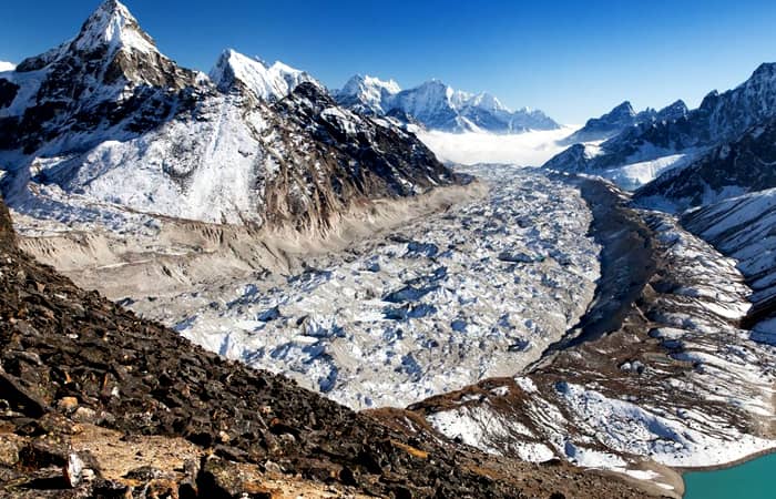
The Nanda Devi group of glaciers refers to a cluster of seven glaciers, situated inside the Nanda Devi Biosphere reserve in the Chamoli district of Uttarakhand. Among the seven glaciers, Nanda Devi North and Nanda Devi south originate from the Nanda Devi peak, the second-highest peak in India. The group of glaciers form small rivulets and streams which feed the Rishi Ganga River, which joins a number of rivers to go on and become an important tributary of the Ganga River.
The Nanda Devi Biosphere reserve presents a wide range of trekking opportunities, each offering something unique and awe-inspiring. One of the most common treks undertaken is the trek to Nanda Devi East Base camp which starts from Munsiyari and branches off from the trek route to Milam Glacier at Rilkot onwards to the Panchu Glacier.
8. Khatling Glacier
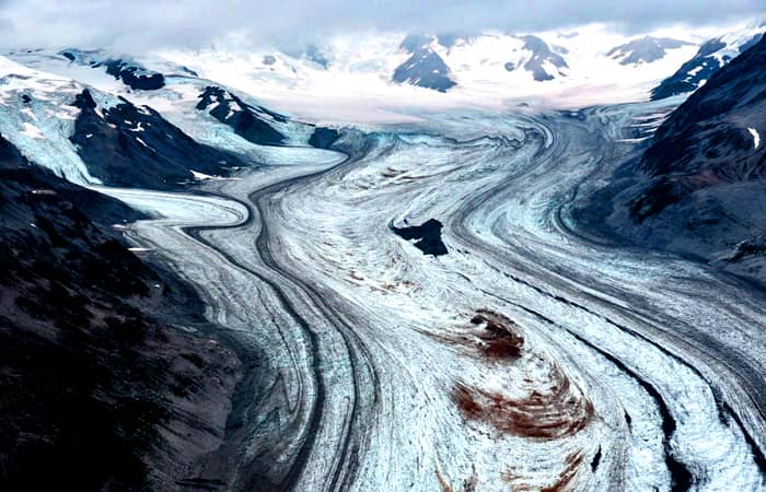
Positioned alongside the Gangotri Glacier, the Khatling Glacier is situated in the Tehri District of Uttarakhand at an elevation of around 3700 metres. Nestled between mighty snow-capped peaks of Jogin group, Sphetic Pristwar, Barte Kauter, Kirti Stambh and Meru, this glacier is the source of River Bhilangna, a chief tributary to the Bhagirathi, the source stream of the Ganges.
There are three possible routes of varying levels of difficulty that one can take to trek to the Khatling glacier, however all three routes are recommended only for those who have experience in high altitude trekking due to their strenuous nature. The most common route taken by most trekkers which takes around 10 days, starts from the village of Ghuttu and ends at Gaurikunda, which serves as a base camp for Kedarnath temple trek.
9. Doonagiri Glacier
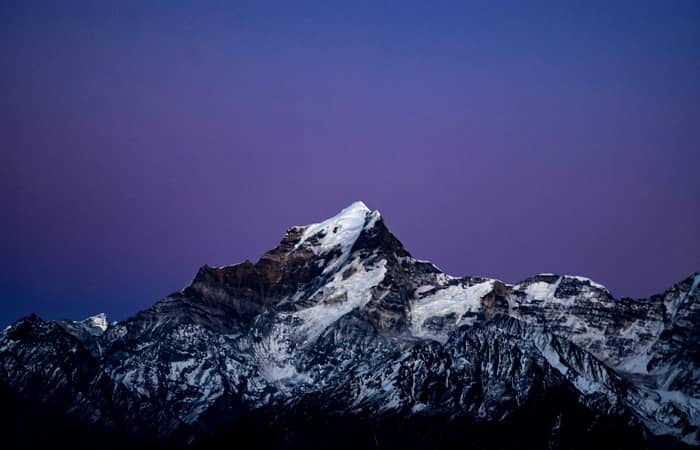
A major glacier of the Dhauli Ganga system of glaciers, which comprises more than 500 glaciers of different shapes and sizes, the Doonagiri glacier is around 5.5 kms in length and stands at around 5000 metres at its highest point. A swift and bubbling brook originating from this glacier merges with the Dhauli Ganga River, which goes on to join Alaknanda, one of the two major sources of the Ganga.
The trek starts from the village of Juma 43 kms from Joshimath, onwards towards Doonagiri Village which can be reached in one day. From Doonagiri village, the glacier can be reached in a single day’s trek, and there are ample spots for camping near the base of the glacier where one can stay for the night before returning back the next day.
10. Satopanth Glacier
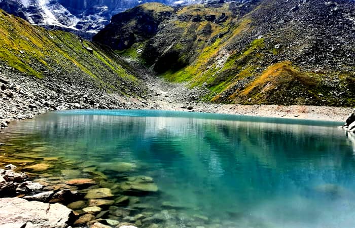
The origin point of Alaknanda, one of the two source rivers of the Ganga, the 13 km long Satopanth Glacier, fed by the ice found on the eastern slopes of Chaukhamba group of peaks, lies on the northwest side of Nilkantha, a major peak in the Chamoli district of Garhwal region.
One of the major trekking routes that attracts adventure enthusiasts and religious devotees alike is the trek to the Satopanth lake which commences from Badrinath. The glacial lake, apart from being absolutely gorgeous and breath-taking in its beauty and scope, is also of utmost importance in Hindu culture, as it is believed that the Divine Trinity, i.e. Brahma, Vishnu and Mahesh used to meditate on each corner of the triangular lake.
From Badrinath, trekkers cross the village of Mana, last village of India on the Indo-Tibetan Border and Vasundhara Falls on their way to Laxmi Van and further to Chakratirtha. Surrounded by the peaks of Chaukhamba, Neelkanth, Satopanth, Parvati and Balakun, the views from Chakratirtha are a sight to behold.
The Satopanth Lake lies 5 km further up the trail, and trekkers can make the journey to the lake and back in a single day with ample time to enjoy the incomparable natural beauty of the place. Avid trekkers and adventure lovers can further continue the trek from the lake up to the Swargarohini Glacier base camp via Chandrakunda and Surajkund, tracing the mythical steps of the Pandavas as they ascended on this path on their way to heaven.
Frequently Asked Questions
Is Gaumukh trek difficult?
Gaumukh trek ranges between moderate to difficult zones. Mainly because the trek takes you through some challenging geography at high altitude. You will be faced with forests, rocky terrain with stones and boulders blocking your way. You don’t have to be an expert trekker or a mountain climber but you will be required to have strength, stamina and endurance.
What route will I be following for the Pindari Glacier trek?
You will be following this route – Kathgodam – Kharkia – Khati – Dwali – Phurkia – Zero Point – Pindari Glacier – back the same route you came. The trek will start from Khati village.
What is the legend behind the Bandarpoonch Parvat?
The name of the mountain translates to ‘monkey tail’ mountain. It has been named so because according to legends, after wreaking creating havoc in Lanka from his burnt tail, lord hanuman is believed to have come to this mountain to extinguish the fire. The fire that could have been only extinguished here and nowhere else.
How many glaciers are there in Uttarakhand?
There are 1439 glaciers in Uttarakhand which covers an area of over 4,000 kms. All these glaciers are divided and subdivided into different ranges and groups like Gangotri Group, Kamet Group, Satopanth Group, Dhauliganga Group etc.
How do I get to Johar valley?
Trekking is the only way to reach Johar Valley which starts from Munsiyari. Munsiyari can be easily reached from Delhi to Kathgodam via Almira.
Which is the largest glacier in the Himalayas?
Siachen is the glacier in the Himalayas outside of the polar regions. It is 76 kms long, located in the Karakoram and is the longest glacier in the Himalayas region.
Which is the smallest glacier in India?
Gangotri glacier is the smallest is India.
Which river originates from Satopanth Glacier?
Alaknanda river, that moves past Badrinath temple, originates from Satopanth Glacier. This river meets uttar gang upstream to Alka Puri and then at Mana village Alaknanda River meets Saraswati which goes on to drain into the Badrinath basin.
What is the legend of Dronagiri Mountain?
In Ramayan, when Laxman was wounded it was up to Hanuman to go get the medicine from the hills of Uttarakhand. He got confused about which medicine to bring and instead he picked up the whole mountain rock and brought it to Laxman so that everyone who is badly wounded gets the medication they need. It was this Dronagiri Mountain that was brought by Lord Hanuman that was said to contain Sanjeevani Booti.
What are some nearby glaciers to Kafni Glacier?
Some other glaciers you can explore nearby include Pindari Glacier, Maiktoli Glacier and Milam Glacier.
[ Click Here to Enquiry for Uttarakhand Tour Packages ]


 Call
Call WhatsApp
 Enquiry